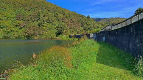
Photo of the Old Dam in 2022. The reservoir was once thirty feet deep but was largely filled when...
Wainuiomata: Photos
Photographic timeline of Wainuiomata
Documenting Wainuiomata with an ever growing collection of photos. This includes locations such as the town centre, suburbs, landscapes, coastline, rivers, and reserves.
Photo articles are dated by the age of the main photo or the main subject rather than when the article was written. This places the photos in a timeline. Some photos date back to the 1800s. We either have permission to show these old photos or they have no copyright. Modern photos on the site were taken by David Johnson of Wainuiomata.Net unless otherwise specified.
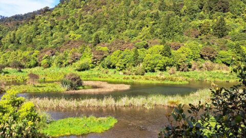
Looking at a wetlands area located behind the old dam. When the dam was decommissioned, the area became an...
Pre-settlements and a huge earthquake in 1855, much of the valley floor in Wainuiomata was wetlands or swamp.
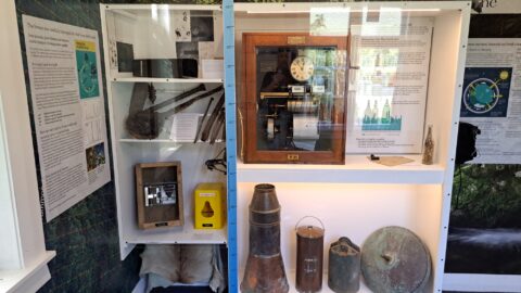
The Wainuiomata Historical Museum proudly houses a diverse collection of historical exhibits that vividly depict its rich heritage.
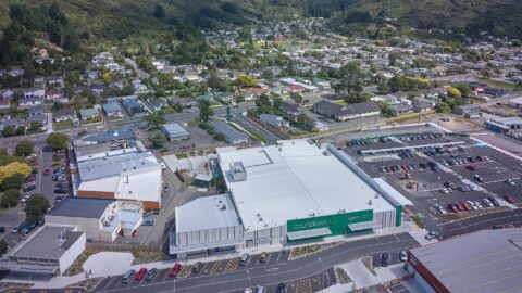
Looking at Woolworths from above in the year 2022. It shows the 3,600 square meters of supermarket space, and...
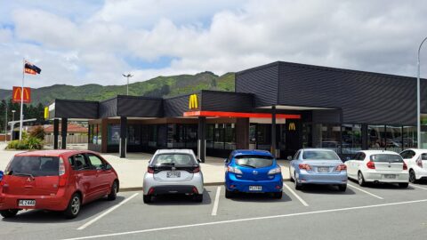
McDonald’s opened its restaurant in Wainuiomata, on April 13, 1999. Located on The Strand, it is across the...
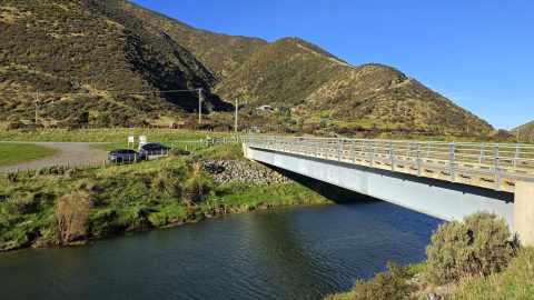
Lighthouse Bridge crosses the Wainuiomata River near Baring Head, providing access from Coast Road to East Harbour Regional Park.
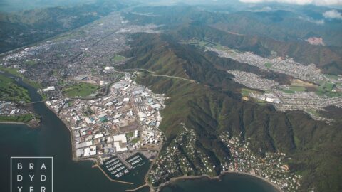
The Pukeatua Range, also known as the Wainuiomata Hill Road, runs through the centre of the image with Wainuiomata...
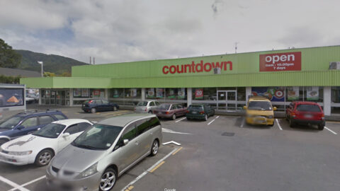
360 degree view of Countdown in Wainuiomata in October, 2013. The first Countdown supermarket in Wainuiomata opened in 1970.
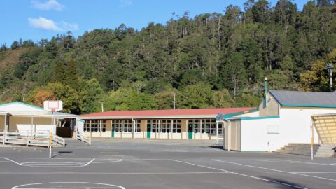
Established in 1857, Wainuiomata Primary School, a state school, resides in Homedale, the oldest suburb in Wainuiomata.
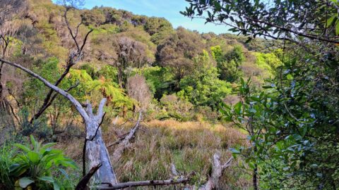
Looking at the valley that contains Nikau Creek and the Nikau Creek Track, (circa 2009). This is where the...
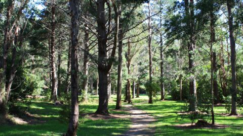
Pictured is a meadow on the Gums Loop Track in the year 2009. Gums Loop Track has existed as...
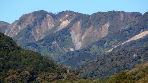
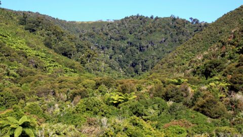
View of Clay Ridge in Remutaka Forest Park. Clay Ridge can be reached by taking the Clay Ridge Track....
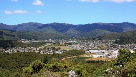
Wainuiomata Valley as seen from the summit of Wainuiomata Hill in the year 2009. This is prior to the ...
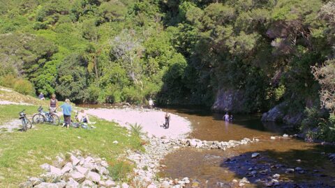
Top Pool in Wainuiomata in the year 2008. This area is a cherished destination for swimming and even picnics.
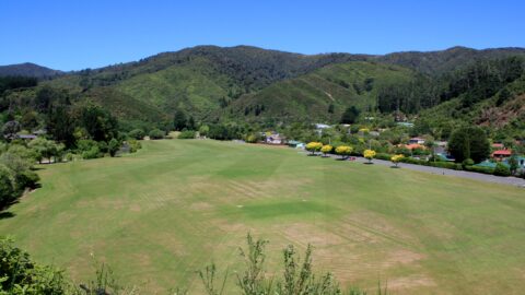
View of Richard Prouse Park in Wainuiomata. Photo was taken from Moores Valley Road above the Wainuiomata River in...
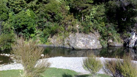
Photo of Top Pool in Wainuiomata taken in the year 2007. This pool has always been known as a...
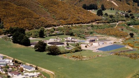
The Wainuiomata Wastewater Treatment Plant was decommissioned in November 2001 after serving the community since the 1950s.
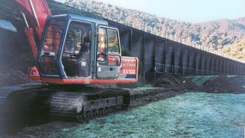
Photo taken in the mid 1990s of the Pollards building a trench for the installation of a new scour...
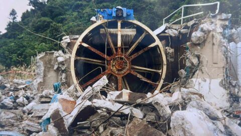
Pictured is the dismantling of the Morton Dam strainer facility during the 1990s. Morton Dam was decommissioned earlier in...
WAINUIOMATA TOURS

Step into the wilderness of Wainuiomata and experience it for yourself. Learn more →.
WAINUIOMATA MUSEUM

Located in Wainuiomata Primary School, it is open 2pm-4pm every Sunday. Learn more →.
BUY ME A COFFEE
Support Wainuiomata.Net with a donation and help us continue to uncover local history, capture photos, drink coffee, and promote Wainuiomata.
Scan or click the code below:


DISCUSSION