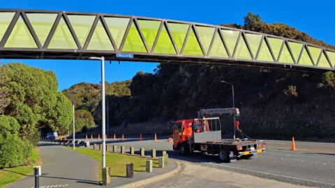
The Pukeatua Bridge crosses over the top of Wainuiomata Hill Road. The bridge links pedestrian and cycling pathways along...
Wainuiomata: Photos
Photographic timeline of Wainuiomata
Documenting Wainuiomata with an ever growing collection of photos. This includes locations such as the town centre, suburbs, landscapes, coastline, rivers, and reserves.
Photo articles are dated by the age of the main photo or the main subject rather than when the article was written. This places the photos in a timeline. Some photos date back to the 1800s. We either have permission to show these old photos or they have no copyright. Modern photos on the site were taken by David Johnson unless otherwise specified.
Feel free to ask a question in the comments below about any photo displayed in this website.
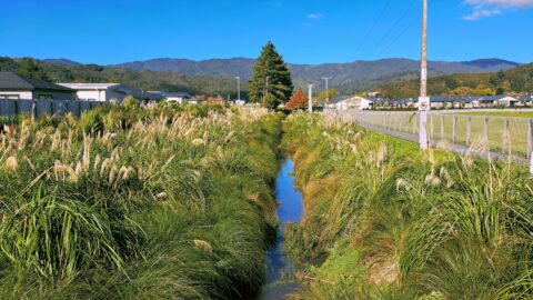
This section of the waterway has been restored with native vegetation and features a public walkway between two new...
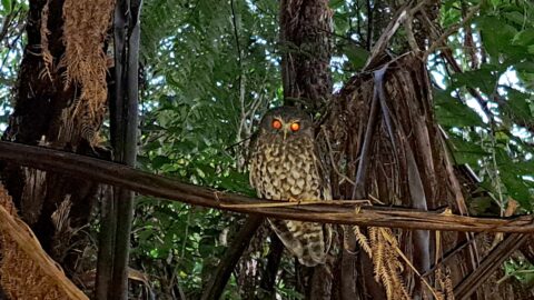
The Morepork is a small owl native to New Zealand. It gets its name from the sound of its...
Secret Pool (also known as Indian Pool) is a swimming hole in the Wainuiomata River. It is the next...
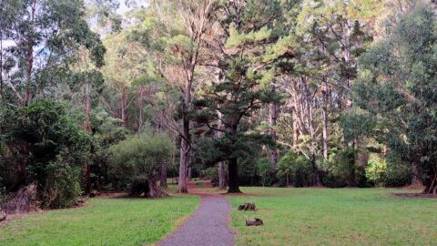
Gums Loop Meadow is essentially where Gums Loop Walk derives its name. The meadow contains eucalyptus trees.
Gums Loop Swamp is a wetlands located near Gums Loop Meadow. This wetland is basically hidden away as it...
This view can be seen from the Old Whakanui Track. The track’s entrance is mostly hidden from view as...
Typical overcast day in Autumn as seen from the Wainuiomata Hill Lookout. The view here is always good, no...
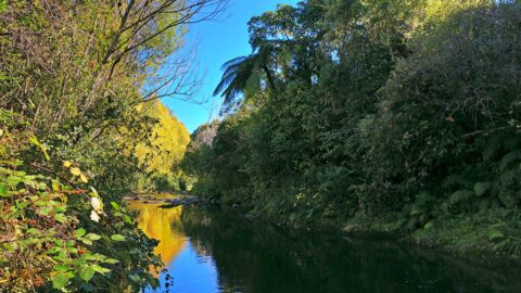
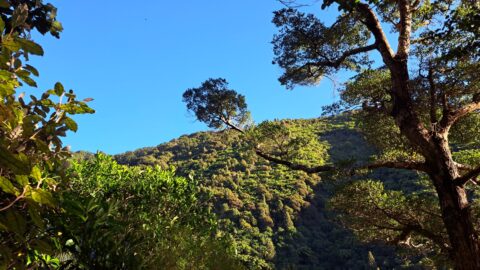
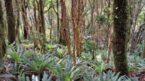
View of lush forest on the McKerrow Track. The track follows a ridge and offers some great views of...

On March 25th, a new KFC branch commenced operations in Wainuiomata. Situated at 18 The Strand, it stands opposite...
As dusk falls over Wainuiomata, the setting sun bathes the landscape in its warm, reddish hues, casting shadows across...
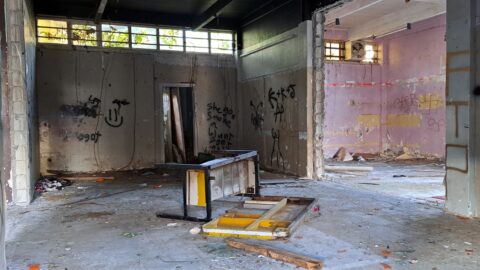
The once bustling shops in The Village, Homedale’s historic commercial heart, now sit in varying states of decline and...
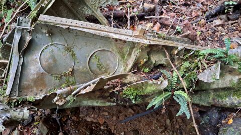
A fragment of aircraft fuselage, serves as a poignant reminder of a wartime training accident that took place more...
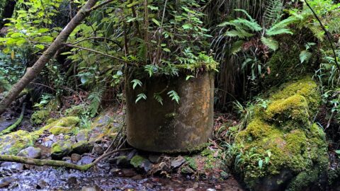
This cylindrical structure was once part of the Skerretts Creek water catchment. The catchment itself ceased operations in the...
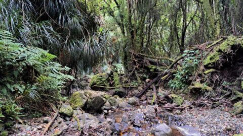
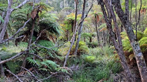
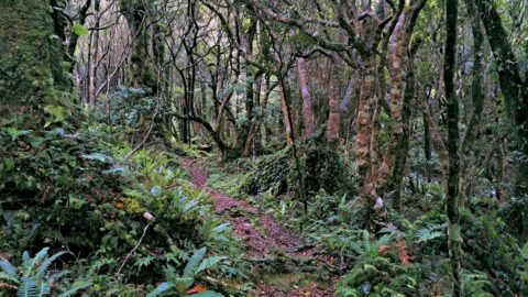
Lush rainforest surrounds much of Skerretts Creek, but the vegetation thins out slowly as you head up the slopes...
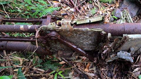
This is part of a plane wreck, specifically the landing gear, from a kittyhawk that crashed in 1943. Other...
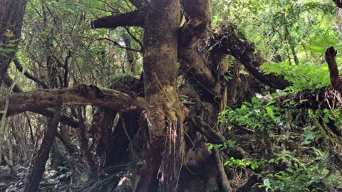
At some point, a landslide has moved these trees farther down the steep incline beneath the McKerrow Track.
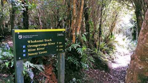
A misspelling on this sign says 'Hine River' when it should say 'Hine Road'. The river that flows along...
View of a lush forest on the slopes of Skerretts Creek Valley. The forest is beautiful, but not far...
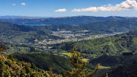
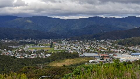
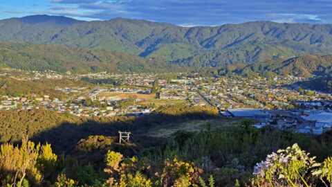
This view from the Whakanui Track gives an expansive look at Wainuiomata. Immediately below is Nikau Valley and Moores...
WAINUIOMATA TOURS

Step into the wilderness of Wainuiomata and experience it for yourself. Learn more →.
WAINUIOMATA MUSEUM

Located in Wainuiomata Primary School, it is open 2pm-4pm every Sunday. Learn more →.
BUY ME A COFFEE
Support Wainuiomata.Net with a donation and help us continue to uncover local history, capture photos, drink coffee, and promote Wainuiomata.


DISCUSSION