Looking for a five metre waterfall meant dodging pellets, scrambling down steep slopes, and getting lost.
The highlight of my previous bush bash was discovering an unnamed waterfall, and today I wanted to check out another waterfall over the otherside of the ridge. Unlike the waterfall I found last week, this one is well known, yet somehow I had never visited it, despite having been in the area before.
Like last week, I started at the top of Sunny Grove, although this time I was by myself. I headed up the Mt Crowther Track and, near the beginning, came across two teenagers doing target practice with a pellet rifle. I walked past them hoping they were not serial murderers. Thankfully, they were not.
The slopes here are brutally steep, and the climb to the summit at 377 metres is no joke. Once at the top, I needed to locate an unofficial route known as McKerrow Ridge Track. Coming from this direction, however, it was very difficult to find. I think I may actually have stumbled onto it at one point, but turned around because it looked as though I was heading the wrong way. Looking back now, I suspect it probably was the correct track, as it actually curves gradually toward the ridge I was aiming for.
According to a hand drawn 2003 map of the area, there were three different tracks somewhere in this vicinity. I only needed to find one of them to get near the area I was heading for. One of the routes followed an entirely different ridge from the other two, although all three eventually appeared to reach roughly the same destination.
Unable to locate the ridge track, I decided to bush bash downhill in what I believed was the correct direction. The slope was extremely steep and required plenty of handholds, fortunately there was no shortage of trees and vegetation to grab onto. At one point I completely lost my footing, but managed to hold onto a branch strongly enough to stop myself from sliding down a bank.
Further down, the terrain eased into a flatter section where I picked up a bait line track which, in hindsight, I believe was Bruce’s Track. The route was marked with colourful tags, making it relatively easy to follow. The track itself is narrow and steep, tracing the spine of a spur as it descends toward the Coast Road valley. In places the ridge narrowed dramatically, with steep drop offs falling away on both sides.
As I continued downward, I could hear a creek below. The track zigzagged down the steepest section of hillside before finally crossing this creek. Soon after, I emerged from the bush onto a grassy hillside where a hut stood. I had arrived at Camp Wainui, the old Boys’ Brigade camp.
From there I followed a track so muddy that one wrong step could end in me doing the splits. This muddy route skirts the bush edge and passes a few wooden buildings, including one that appeared to be getting a new deck. I carried on confidently enough because I had been to this area before while walking the Bivy Track a couple of years ago.
I passed the bivy that gives that track its name, but my main goal was to get on Scholes Creek Track, which follows Scholes Creek where the waterfall is located. According to the 2003 map, it was supposedly only a 25 minute walk along this track to the falls. By this stage, however, I only had about an hour of daylight left. Twenty five minutes there and another twenty five back seemed manageable, but once I returned to Camp Wainui I would now need to walk out to Coast Road. There was no realistic chance of climbing back up to Sunny Grove and navigating the ridges in the dark.
I lost count of how many times the track crossed the creek, although thankfully my boots kept my feet mostly dry. I continued along Scholes Creek Track, but the waterfall remained nowhere in sight. I believed the track ended at the waterfall, yet the track just kept on going. Eventually I started wondering whether I would actually reach it before darkness fell.
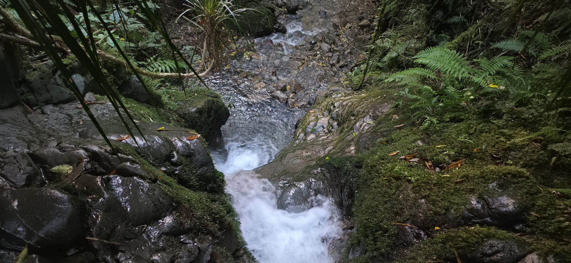
Just as I was debating whether to turn back, the track and creek merged into a rocky section where large boulders filled the stream bed, and where you are suppose to climb up and down over the rocks to maintain the track. Then, finally, the waterfall came into view.
It was not as tall as the waterfall from last week, but it was scenic. I spent some time photographing and filming the falls before climbing to the top for views looking down at the falls from above. Then it was time to move quickly. I did not want to get caught in the bush after dark.
By the time I emerged from the forest there was still some light left in the sky, although the sun had already set. I walked through the camp and out onto Coast Road. But the adventure still was not over. I now faced another hour walk along Coast Road and Hine Road back to the top of Sunny Grove.
Eventually I reached my car, although by then I was barely walking properly. When your legs are completely exhausted, your gait becomes something unique.
All up, it was a great adventure. I nearly got shot at the beginning, got lost on steep ridges, scrambled through muddy bush tracks, climbed up and down punishing slopes, and was ultimately rewarded with a beautiful five metre waterfall. I even ended the evening wandering suburban streets at night, which, strangely enough, I quite enjoyed.


