My first look at East Harbour Regional Park
Today seemed like the perfect day to venture into East Harbour Regional Park which I had not visited before. I had tried to visit two years ago, but the park was closed at the time due to fire risk. This time, the conditions were ideal. It was cold but sunny, and since most bush bashes take place beneath the forest canopy, this open coastal landscape offered some direct sunlight and the promise of clear views.
Wind was forecast for later in the evening, but this part of the south coast is windy even on calm days. I do not think I have ever visited the Wainuiomata coastline without experiencing strong wind.
I started near the end of Coast Road, crossed Lighthouse Bridge, and joined the Grand Loop Walk, a vehicle-width track that winds its way up the hill. The views back down Coast Road Valley were stunning. Once at the top, I detoured to Parangarahu Pā, then continued on to a lookout, which offered excellent views west along the south coast towards the entrance to Wellington Harbour.
From there, I rejoined the Grand Loop Walk and continued towards Baring Head Lighthouse. The wind began to pick up, but even so, the views down towards Fitzroy Bay were spectacular. Below, a perfect surf break was forming, with the onshore wind lifting the waves and allowing them to peel cleanly as a left-hand break. I wondered why this spot was not better known on the surfing map, although some visible rocks probably explain that.
I continued south and reached the Para Hill Observation Post. There were two bunker sites, with three bunkers in total, along with a small water tank. Nearby was an old stone chimney, which I found out later was a barracks for those that manned the posts here. From there, I headed down the steep grassy hill from the trig towards Baring Head Lighthouse. Below, I could see several buildings and a row of macrocarpa trees, which looked as though they had been planted as shelter from the north-westerly wind, which was now blowing as hard as ever.
Once at the bottom of the hill, I made my way towards the lighthouse area and found a track leading toward the south coast. It offered excellent views down to the shoreline, across Cook Strait, and towards the South Island.
The track ended at an entrance to the lighthouse site, where I visited each building and took photos. The middle building called “Power House” was especially interesting, as it now serves as a small museum / visitors centre called “Story Hub”. Its old front door automatically opened as I approached, revealing displays, artefacts, and audio recordings inside that helped tell the story of the site.
After exploring the buildings, I headed to the Baring Head Lighthouse where more views of the south coast and beyond presented themselves. I then left the lighthouse area and joined the Grand Loop Walk again, where the views to the south-east were outstanding.
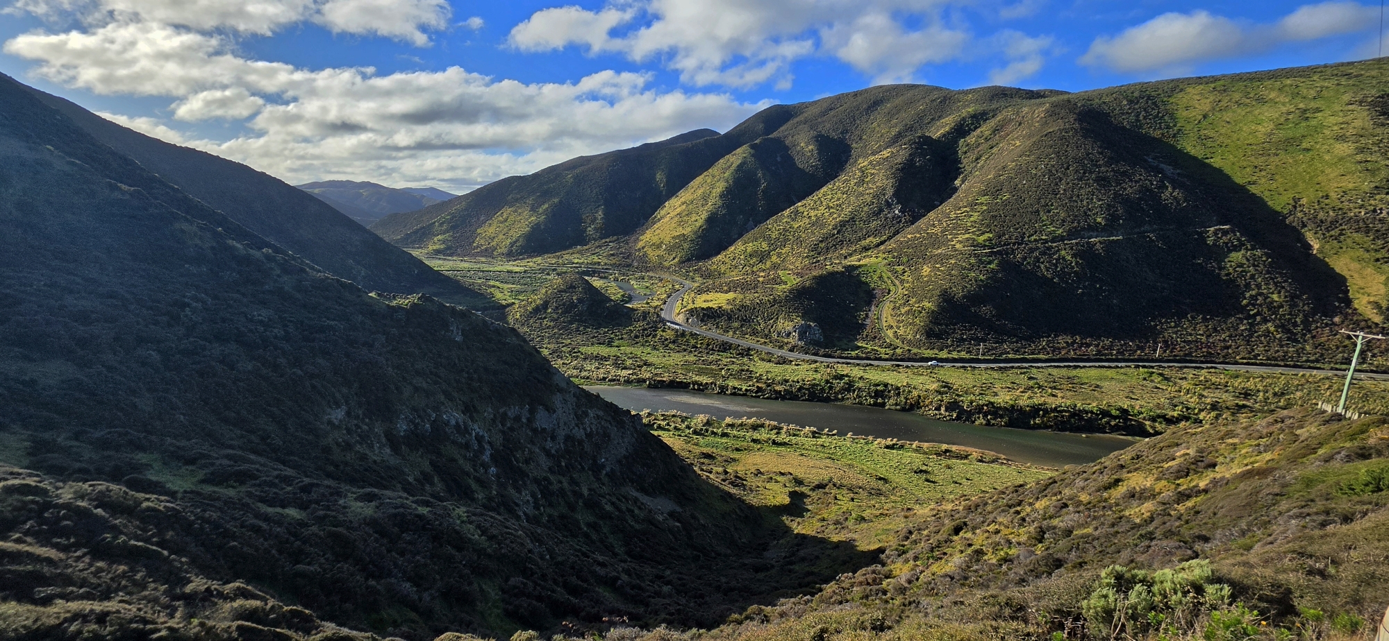
From there, I descended east toward the Wainuiomata River and the Oxbow Loop Walk, a flat river walk that led me back towards Lighthouse Bridge. Along the way, there were pleasant river views and clear evidence of earlier river channels, still visible in the landscape.
I arrived back at the bridge about five hours after setting out and didn’t feel as sore compared to a 5 hour bush bash. Regardless, I had a great time and want to return as the area has a lot more on offer including two coastal lakes.


