I explored a possible original entrance to the Old Whakanui Track following an overgrown route through gorse and native bush.
Today, I headed into Wainuiomata Regional Park without a firm plan, intending to decide where to explore once I arrived. I often begin with a particular route in mind but end up deviating from it, so this time I decided to embrace that approach from the outset.
I followed the Gums Loop Walk above Top Pool and passed the entrance to the Nikau Creek Track. After crossing the nearby bridge over Nikau Creek, I noticed what appeared to be a faint track running along the eastern side of the creek. I followed it, knowing it would eventually lead into a terrace area I had explored many times before.
Once on this terrace, I spotted something in the distance that looked man-made but could not immediately identify it. As I moved closer, I realised it was an A-frame camping fly pitched over a stretcher. Not knowing whether anyone was nearby, I decided not to approach it too closely.
From there, I moved behind the swampy area bordering the Gums Loop Walk and began climbing the hillside, with the next creek beyond Nikau Creek running below me. Eventually, I reached the spine of a spur, where the terrain immediately gave me the impression that an old track had once followed the ridge.
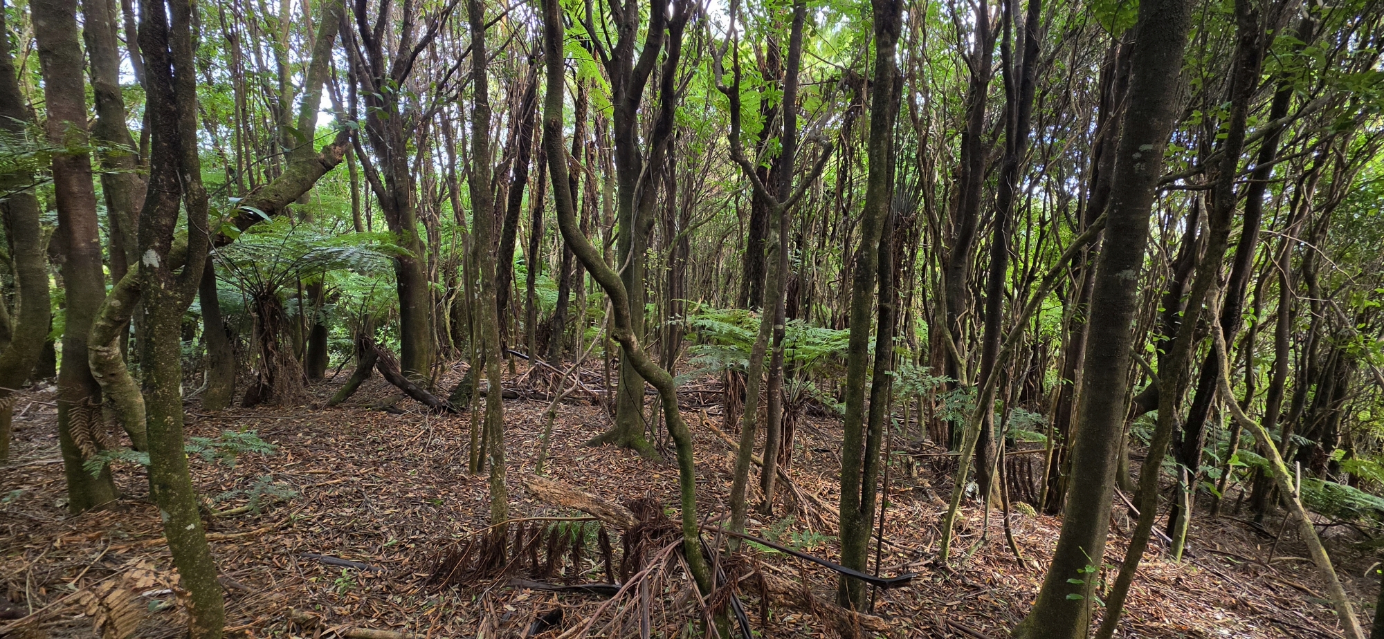
I began following it, but, like many abandoned tracks, it was partly concealed by dense young mānuka and gorse, making progress slow and uncomfortable. Whenever the vegetation became too thick to penetrate, I moved east or west down the hillside into more established native bush, then bashed my way back towards the ridge and rejoined the suspected track.
 I wondered what the route might have been. Could it have been one of the old Geological Survey tracks? Eventually, I found a weathered white plastic ribbon tied around a tree, confirming that the route had been marked at some point. Judging by its condition, the marker may have been there for between 10 and 30 years, although it is impossible to date accurately from appearance alone.
As I continued climbing, I thought about my previous bush bash, during which I had walked the various known versions of the Whakanui Track over the years. There was still one section I had never traversed: the earliest known entrance to the Old Whakanui Track.
The entrance in Nikau Creek Gully was apparently not the original route. An earlier entrance began in Reservoir Valley but was eventually overtaken by gorse, leading to the Nikau Creek Gully approach replacing it. This made me wonder whether I was now following that original entrance of the track.
I reasoned that if the route eventually connected with the Old Whakanui Track, there was a reasonable chance that it was the former entrance. The historical description also fitted what I was seeing, as gorse still covered considerable sections of the route.
As I climbed higher along the spur, the gorse gradually diminished and was replaced by mānuka and other small native trees, although scattered patches of gorse remained. I found several more white ribbon markers, some still tied to trees and others lying on the ground. However, I did not encounter any traps, including old or abandoned ones. This suggested it was not currently a bait line, although it may have served that purpose in the past.
The track then entered a flatter area that appeared to be another spur running perpendicular to the one I had just climbed. It was tempting to follow this route downhill because it passed through particularly attractive native bush. However, doing so would have left unanswered the main question: did the route I was following connect with the Old Whakanui Track, and could it have been the original entrance?
Beyond this point, the route became difficult to trace. I climbed over a high point, descended, and then began climbing again. Eventually, I found another marked section, this time identified by a blue ribbon. I bush-bashed along it and later found a second blue marker, although the markers were widely spaced.
I lost the route again but managed to climb towards another elevated section. There, I finally reached the Old Whakanui Track, which I recognised by an orange marker and another blue ribbon.
To confirm my location, I followed the track uphill until I found a pink marker labelled “OW”, meaning Old Whakanui. This confirmed that I had reached the track. It also strengthened the possibility that the route I had climbed was the original entrance that was later replaced by the Nikau Creek Gully approach.
If that interpretation is correct, I have now walked every known version of the Whakanui Track that has existed over the years.
Once I had fully confirmed my location, I turned around and followed the Old Whakanui Track downhill, emerging at Nikau Creek and then joining the Nikau Creek Track. While walking along it, I noticed another pink marker, apparently labelled “OW15”. Although I was now on the Nikau Creek Track, this made sense because part of that route once formed part of the Old Whakanui Track.
It was a beautiful sunny day when I emerged from the bush. After returning home, I examined an aerial photograph of the area taken in 1974 and saw that several Geological Survey tracks had existed there.
This left me with one final question: had I followed the original entrance to the Old Whakanui Track, or had I climbed an old Geological Survey route?
I believe it was most likely the former, although it may have served both purposes. Perhaps one of the Geological Survey tracks followed part of the original Whakanui route. The fact that the track connected directly with the Old Whakanui Track makes a strong case that it was the original entrance, as there would otherwise seem to be little reason for a Geological Survey route to form such a direct connection.
After writing this up, I realised I had actually found this track once before. Back in Bush Bash 66, I started in Nikau Creek Gully and followed a tributary of Nikau Creek up the eastern flank. I eventually had to abandon that route and climb to the top, where I came across the track. I made a mental note to return and explore it further, but then completely forgot about it.


