Following Three Iterations of the Whakanui Track
In Bush Bash 76, I followed Nikau Creek as far as I could before heading up the hillside and eventually stumbling upon the East Whakanui Track. Today, I decided to return to the area and complete a loop around Nikau Valley by combining three tracks: the Old Whakanui Track, the East Whakanui Track, and the current Whakanui Track.
This would involve a steep climb out of Nikau Creek Gully, a ridgeline walk around the upper valley, and a descent back towards Sunny Grove. I was also open to deviating into any tight gullies along the way if they looked like they might contain waterfalls, especially after the heavy rain the day before.
The Whakanui Track has changed its starting point several times over the years. At one stage, it began directly from Reservoir Valley and climbed the hillside toward McKerrow Ridge. Later the entrance to that same track was changed to Nikau Creek Gully (where I was heading), then in the 1980s, the entrance was moved to the Hine Road Recreation Area beside Sinclair Cemetery. It was moved again to its current entrance above the top of Sunny Grove. As I understand it, some of these moves were made to keep people away from the water catchment in Reservoir Valley.
These changes have left several older sections of the track behind. Most now receive minimum maintenance as baitline tracks and are not signposted for the general public. These older sections are recognised under different names, including the Old Whakanui Track and the Sunny Grove Track.
The Old Whakanui Track is said to have begun as a Māori trail used as a route towards the Wairarapa. However, the entrance I used appears to be a more recent creation. Before the 1970s, the track reportedly climbed directly from Reservoir Valley rather than from Nikau Creek Gully. That older entrance was eventually abandoned after gorse took over the hillside. The Nikau Creek entrance is the one I know best, as I walked this track many times as a young kid living nearby.
I began on the Gums Loop Walk, then connected with the Nikau Creek Track. Just over 500 metres along, a basic rock cairn marks the entrance to the Old Whakanui Track. After crossing Nikau Creek, the climb began almost immediately. It was a steep ascent, rising hundreds of metres up the hillside. The track was still visible, and there were plenty of tree roots, trunks, and branches to use as handholds while hauling myself upward.
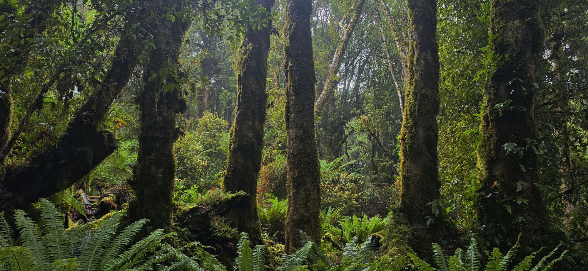
Eventually, I reached a flatter area, which marked the end of the steepest section. From there, the track climbed onto the spine of the ridge that heads towards McKerrow Ridge. There was still plenty of elevation ahead, but the gradient became more manageable, apart from a few shorter steep sections. This was also where the bush became especially scenic. Large trees, lush green undergrowth, and a quiet misty atmosphere made this section a pleasure to walk after the hard climb.
The ridgeline seemed to go on and on. With mist covering the hills, there was no distant visibility, making it difficult to judge how high I was or how much climbing still remained. I continued along the ridge and eventually reached the East Whakanui Track. I realised this when the bait station markers, which had previously been labelled “OW”, presumably for Old Whakanui, changed to “EW”, which I took to mean East Whakanui.
Instead of immediately turning to walk toward the Whakanui Track to complete the circuit, I continued a short distance towards the Orongorongo Valley where that track ends, in the hope of catching a glimpse of that valley. However, the trees blocked most of the view, and the mist was thick enough to not see anything even if there was a break in the trees.
So I changed direction and followed the East Whakanui Track back towards the Whakanui Track. The scenery along this ridgeline was magical. The track appears to receive moisture from both sides, and the bush reflected that. Many of the trees were draped in moss, and some sections had the feel of a goblin forest.
I continued along the ridge, expecting to reach the Whakanui Track fairly quickly, but the route kept going. A couple of times I wondered if I had somehow turned the wrong way and was heading towards the Orongorongo Valley instead, especially when the track began descending. I had expected this section to be relatively flat because it followed a ridgeline. Those doubts disappeared when I recognised two unusual trees I had seen during Bush Bash 76, when I had bush bashed up from the gully below and reached this same track.
From that point, I knew it was only a short walk to the Whakanui Track and McKerrow Track intersection, and I was right. Once I reached the junction, it was an easy walk down the Whakanui Track to the top of Sunny Grove, although by then my arms and legs were starting to feel the effort of the climb and the long ridge walk.
In the end, I found an excellent loop walk that can be completed in about five or six hours. By adding the Sunny Grove Track, it is possible to start and finish at the Hine Road Recreation Area car park and claim you have walked the Whakanui Track and all its older routes.
In conclusion, this circuit should not be underestimated. While the tracks have markers in places, there are also sections where markers are missing or difficult to follow. It is easy to stray from the route, especially in poor visibility. For that reason, this loop is best suited to people who know the area, are confident away from the main tracks, and have a good sense of direction. I lost the track several times and had to return to the previous marker, then try a different direction until I found the next marker.
Despite the challenging climb at the beginning, much of the landscape near the top of the hillside and along the ridge was outstanding. The bush here is in pristine condition and provides habitat for numerous kiwi, giving the area a sense of remoteness and ecological richness. It has quickly become one of my favourite natural sites.


