Today, I set out to visit Wainuiomata’s south coast, with Turakirae Head Scientific Reserve as my main destination.
Rather than a bush bash, I decided today would be a coastal adventure to an area of real scientific importance. My destination was Turakirae Head, on the south coast near Wainuiomata, where a scientific reserve protects one of the most remarkable raised beach landscapes in New Zealand.
I drove to the Wainuiomata coast, then turned left towards Orongorongo Station. I parked in an unsealed car park near the entrance to the historic Orongorongo Bridge, where I stopped to take photos. The bridge, built in 1914, has long been part of the access route into this rugged coastal landscape. After crossing it, I joined the wide Wild Coast Track, which heads away from the station and follows the coastline towards Turakirae Head.
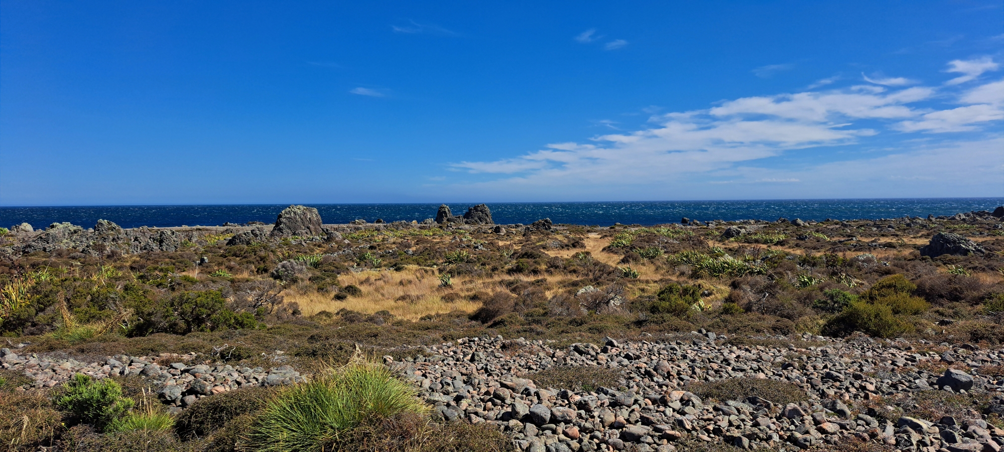
The landscape quickly took on a distinctive character. Large rocky outcrops, scattered stones, low coastal vegetation, and open windswept ground combined to create an ecosystem unlike anywhere else I had visited recently. Further along, the track split. One route led towards the seal colony, but I decided to leave that for another day. Instead, I continued towards the scientific reserve, keen to round the headland and look into Palliser Bay. Although the landscape was not highly varied, it had enough texture, scale, and uniqueness to keep my interest and inspire plenty of photos.
On entering the scientific reserve, it is easy to wonder why the word “scientific” is used. Turakirae Head is protected because it contains a coastline of major geological importance, especially its earthquake-raised beaches. These old beach ridges mark former shorelines that were lifted by powerful earthquakes, including the great 1855 Wairarapa earthquake. The reserve is therefore more than a scenic coastal area; it is a natural geological record, revealing the history of earthquakes, land uplift, sea-level change, and coastal formation along this part of the Wainuiomata coast.
From the track, I could see clear examples of older and ancient coastlines. These were defined by lines of rocks and boulders that still trace the shape of former shores. The youngest raised ridge was lifted during the 1855 earthquake, while the oldest recognised beach ridge is around 7,000 years old, with the possibility of an even older shoreline beyond that. Including the present-day coast, you are effectively looking at six shorelines from different periods in time.
Continuing around the head, the view across Palliser Bay was spectacular. To my left, the easternmost extent of the Remutaka Range framed the coastline, giving the area a remote and dramatic feel. In theory, I could have walked all the way to Lake Ferry, but returning to my car would have been another matter. Instead, I walked as far as Barney’s Stream, where there is a hut nearby. I decided to leave that area for a future visit as well.
The return journey followed the same route, but the views felt different coming back. Coastal walks often reveal new details in the opposite direction, and this was no exception. I spent more time looking at the older raised beaches and exploring the shapes and patterns of the former coastlines.
I made it back to the car in good time and then saw a young family on bikes heading out along the track. They were the first people I had seen all day. At the car park, I also met a man preparing to hang-glide from one of the high points nearby. Given how windy this coastline can be, all I could do was wish him the best.


