I took measurements along the Water Race Pipe Track to predict the route of the water race through unknown sections.
Today I set out to visit each known location where the water race is visible and record a series of measurements. The aim was to establish the relative level of the race by taking altitude readings from the ground at each point. Before starting, I stopped in to see a friend (Tony Weir) who had built and programmed an altitude tracker capable of measuring altitude, air pressure, and temperature. With that in hand, I began the survey.
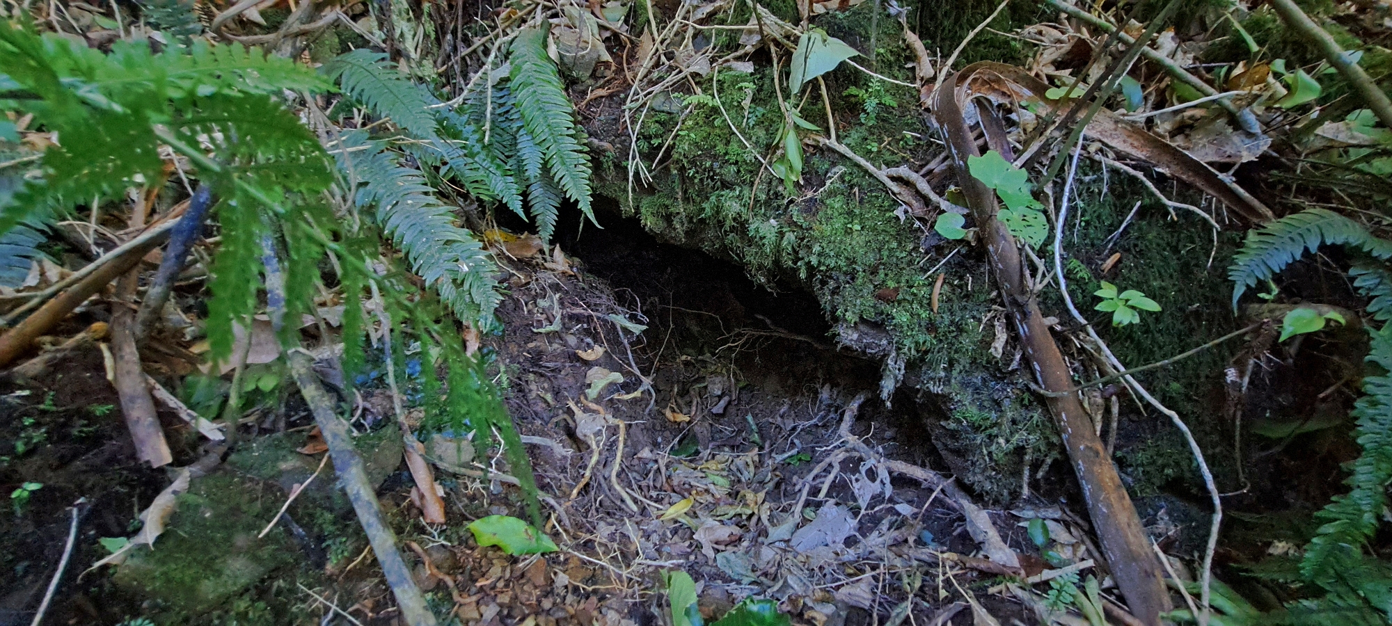
The first location was Scour Pipe. Beneath the pipe is a trench that may form part of the pipe track. My working theory is that the water race could sit below this trench, be incorporated within its wall, or alternatively lie higher on the hillside, just below the level of the earth bridge. I took readings at the base of the trench, the top of the trench, and the top of the earth bridge.
To determine the correct level, I needed comparable readings from other known points along the route. Given that the water race runs nearly level, the objective was to identify which of these elevations aligns with the broader system. This is particularly important in the section east of Scour Pipe, where three possible alignments exist: one near the height of the earth bridge, one along a visible cut track below it, and a third on a lower section of track again. The goal was to establish which of these corresponds with the water race between Scour Pipe / trench and the Old O-K Meter Hut, where the race’s position is certain.
From there, I moved to the Old O-K Meter Hut and recorded measurements from both the hut floor and the window sill. Why the window sill? Because it is possible that the water race roof was near that height, but construction of the meter hut destroyed that section of the water race. I then continued to Coleman’s Tunnel, taking readings at the exposed outside section of the water race. From that point, I walked down the hillside to the road, and headed for the visible section of the race back up the hillside. Next up was a section, where I recorded two readings at a hole in the roof of the race near a manhole. Continuing along the hillside, I measured at two additional manholes before descending to the road opposite the Chlorine Plant, where damage has exposed the race. I then followed the footpath toward the dam, taking a final set of readings near the area where the race is believed to pass beneath, and at the old dam just above the original intake point.
Once the measurements were taken, it was a matter of comparing all readings and establish an average elevation for the water race. This is not entirely straightforward, as each measurement was taken from ground level while the race itself lies at varying depths below. However, I have a general understanding of where it sits closer to the surface and where it runs deeper. By accounting for these relative depths and comparing differences between readings, it should be possible to normalise the data and identify a consistent level.
Once that level was established, I should be able to determine which of the three potential alignments the water race follows in the section between the trench and the Old O-K Meter Hut.
So, what did the data show?
- The crest of the Lower Dam is approximately 123 metres above sea level, placing the water race inlet at around 122 metres above sea level.
- The roof of the water race is visible from Reservoir Road, opposite the Chlorine Station, at an elevation of approximately 122 metres above sea level.
- The roof of the water race is exposed on the hillside near a set of brick steps, at an elevation of approximately 120 metres above sea level.
- The top of the Earth Bridge has an elevation of 123 metres above sea level.
- The bottom of the trench below Scour Pipe is approximately 117.5 metres above sea level, while the top of the trench wall is approximately 118.5 metres above sea level.
- The floor of the O-K Venturi Meter House has an elevation of 116.5 meters above sea level while the window sill sits around 117.5 metres above sea level.
- The roof of the water race is approximately 117 metres above sea level where the exterior of the conduit is exposed next to Coleman’s Tunnel.
So what conclusions or possibilities can be drawn from these measurements?
- From the dam to Coleman’s Tunnel, the water race drops by approximately 5 metres.
- The water race may lie beneath the Earth Bridge, as the top of the bridge is 123 metres above sea level while the water race will be between 122 metres to 118 metres at this location. But, the water race could also be sitting in the wall of the trench near Scour Pipe, as the top of the wall is 118 metres above sea level, while the base of the trench seems too low at 117.5 metres above sea level to be consistent with the race running beneath it. However, I suspect the trench itself marks the line of the pipe track, as following the section of track around the spur in a westerly direction leads directly to it. So the jury is still out as to the exact location of the race in this section of the hillside.
- If the water race is located in the trench wall, then it would continue towards the upper line of the split track located here which is the same elevation as the trench wall. The lower track here seems slightly too low.
- The Old O-K Meter Hut was built over the water race, but probably through it to some degree. The likely level of the water race sits slightly above the hut floor at 116.5 metres high, and toward the height of the window sill less than one metre higher. Looking out through the window, the concrete infill that seals the former water race entrance is visible, with its top aligning between the window sill and hut floor.
- The roof at the downstream end of the water race is approximately 117 metres above sea level. While not significant in isolation, this helps constrain the likely elevation at the Old O-K Meter Hut, which should be at least 117 metres. This suggests the race was positioned above the hut floor, which is approximately 116.5 metres above sea level.
Another interesting thing about the readings was the temperature. The highest temp this day was 27.2 degrees when I arrived at the old dam. It really was a hot Autumn day. Other readings deep in the bush were around 25 degrees.
Note: The device’s elevation readings fluctuated by up to one metre, so an average value was recorded, introducing some uncertainty to the conclusions. Approximately half of the locations were revisited the following week to verify these measurements.


