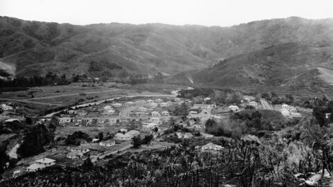
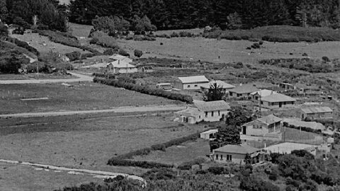
Aerial view of Homedale (mid 1946) showing some interesting features. They are as follows: 9 houses in Poole Crescent;
Wainuiomata: Streets
Discover the streets of Wainuiomata in Lower Hutt and observe the numerous changes over the years, with photos dating back to 1939.
Poole Crescent connects to both Homedale Road and Hine Road, with a reserve situated behind. The street was named...
The photo shows a view along Rowe Parade, taken from the area where Stanley Street and Sharp Crescent would...
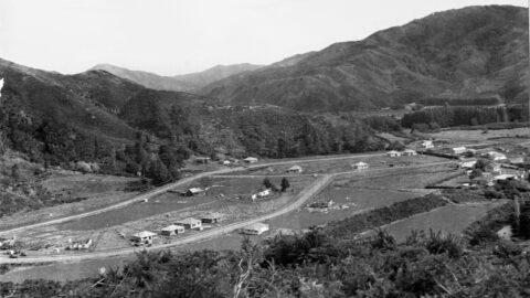
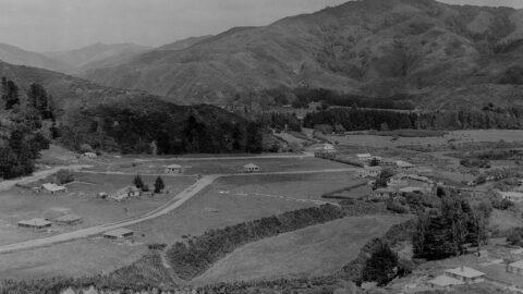
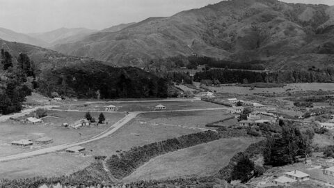
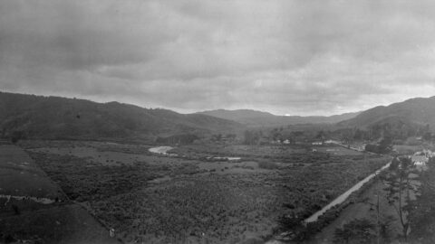
Looking down upon The Village in the year 1946. The outlook encompasses Moores Valley Road, Main Road, and various...
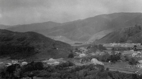
View of Homedale in 1945. Housing development had just begun, with several older farmhouses still visible.
Hine Road, nestled in the heart of Homedale in Wainuiomata, extends from Main Road and culminates at Hine Road...
Aerial view of Homedale (circa 1945) showing some interesting features. Inc: old school buildings and Main Road Bridge.
This photo shows the Williams General Store on Main Road, around 1939. The building was originally part of McIlvride...
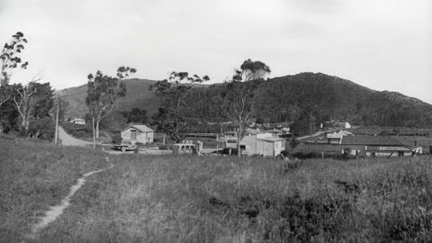
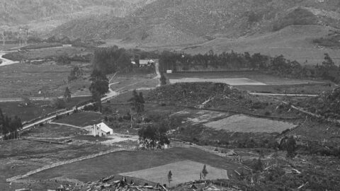
Farmland in Homedale, looking north towards the village from Coast Road. In view are the school, the school house,...
Circa 1941, looking towards Wainuiomata Primary School on what was then known as Wainuiomata Road (now Main Road).
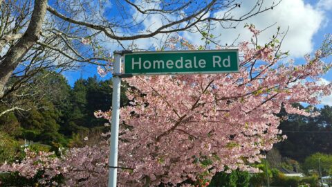
Homedale Road is named after Homedale, the oldest area in Wainuiomata. The name signifies a house located in a...
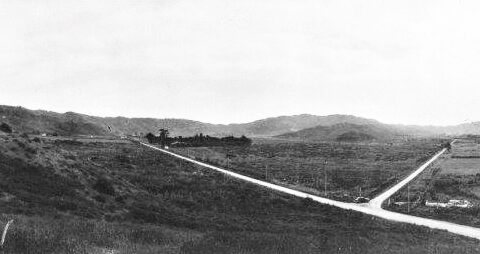
Photo of Fitzherbert Road and Wainuiomata Roads (circa 1939) taken by the Wainui-o-mata Development Ltd; Todd, Harry Jackson (1918-1993).
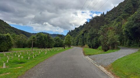
George Creek Road was built in 1922. It runs from Morton Dam to the Wainuiomata entrance of the Ōrongorongo...
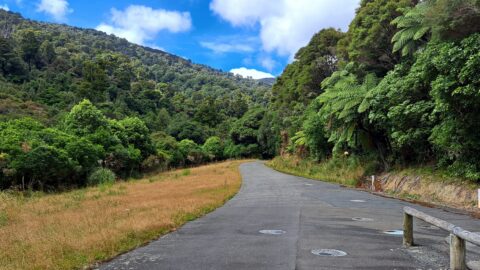
Maintenance Road is an unsealed track that once provided access to the Orongorongo pipeline, from the Orongorongo catchment.
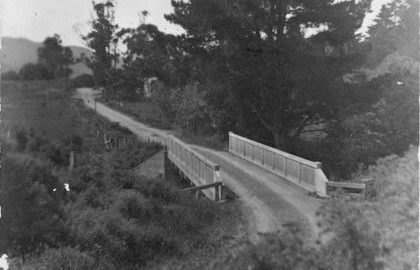
Charles Seymer Whitcher constructed a single-lane concrete bridge across the Wainuiomata River in the year 1916.
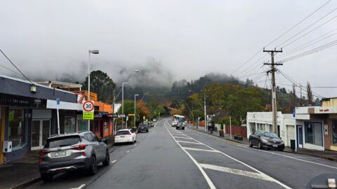
Before 1958, Main Road in Wainuiomata was known as Wainuiomata Road because this area was the focal point of...
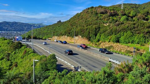
Wainuiomata Road that opens out to four / five lanes and goes over the Wainuiomata Hill. The road rises...
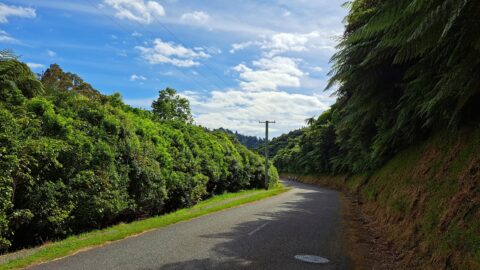
Reservoir Road, a private route for waterworks and council staff, doubles as the Lower Dam Walk on the Gums...
Looking down on the Dick family property in the 1880s, with their home nestled among the trees in the...
30 chains including seven chains of rock in Wainuiomata Valley – Mr Haslam and H. Sinclair will show the...
WAINUIOMATA TOURS

Step into the wilderness of Wainuiomata and experience it for yourself. Learn more →.
WAINUIOMATA MUSEUM

Located in Wainuiomata Primary School, it is open 2pm-4pm every Sunday. Learn more →.
BUY ME A COFFEE
Support Wainuiomata.Net with a donation and help us continue to uncover local history, capture photos, drink coffee, and promote Wainuiomata.
Scan or click the code below:


DISCUSSION