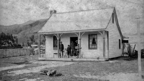
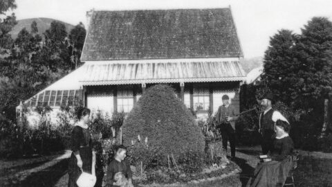
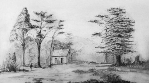
In 1867, John McIlvride, the postmaster, is believed to have constructed the Wainui-O-Mata school masters house.
Wainuiomata: History
Articles exploring the history of Wainuiomata, dating back to the 1860s
Documenting the fascinating history of Wainuiomata with an ever growing collection of articles. Includes posts about the origins and pioneering period of Wainuiomata to historical sites and artefacts. Each article is dated, but the date represents the subject and not the date when the article was written. For example, when an article primarily focuses on a photograph captured in 1840 or discusses topics related to that specific year, the article will be time stamped with that year.
This approach provides readers with an experience, allowing them to traverse through history in chronological order and gain a precise understanding of how historical events and elements are situated within the broader timeline of Wainuiomata’s history. Nonetheless, when an article covers a lengthy period concerning its main subject, it will be time stamped based on the featured image, most recent image, or the date of the main subject.
Read our comprehensive page on Wainuiomata history here →
Historical Articles
The Hutt Rifle Volunteers met at the Taita target on Thursday last, to compete for the above prizes. The...
Board of Wardens for the next two years: Messrs George Allen, John Crowther, George Wood, John Sinclair, J. C....
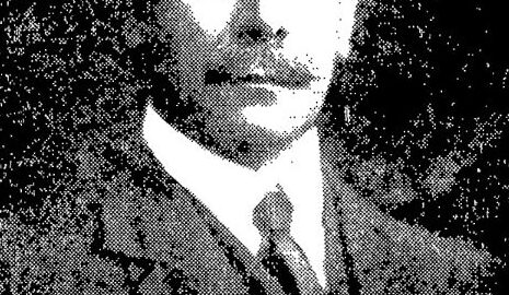
William Hobbard Morton (1866–1923) was Wellington’s Chief Engineer, overseeing key infrastructure projects, including the Morton Dam.
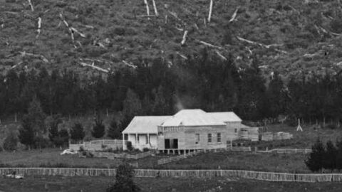
Collis House, built in the early 1860s, is named after the Collis family who settled in Wainuiomata. The house...
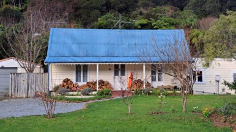
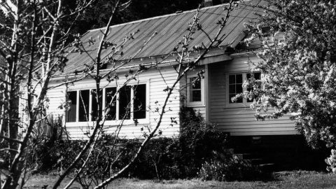
Thomas Scholes (1839–1923) constructed this cottage around 1865 on Coast Road, and it remains standing at 103 Coast Road...
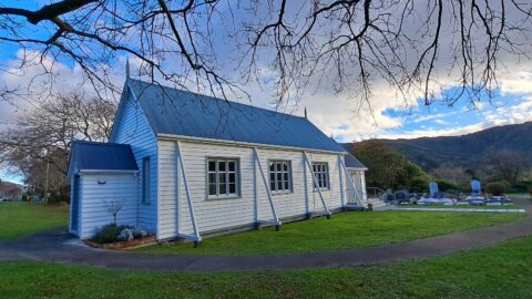
This historic Church, situated in Wainuiomata's oldest churchyard, held its inaugural service on February 6, 1866.
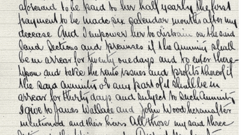
This document records the final wishes of Hugh Sinclair. His wife Agnes did not receive ownership of his principal...
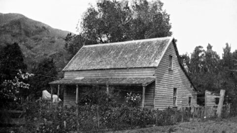
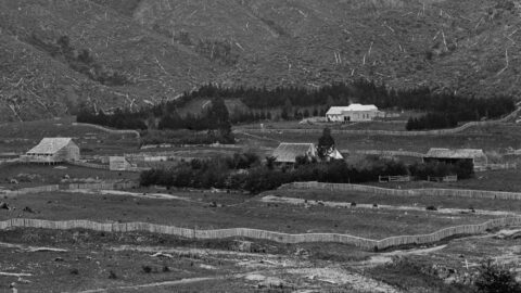
The old homestead, Willow Bank, Wainuiomata was built in 1862. Willow Bank was on the west bank of the...
Constructed in the early 1860s, Sinclair House was the home of Isabella Sinclair (1803 – 1882). Subsequently renamed Dyers...
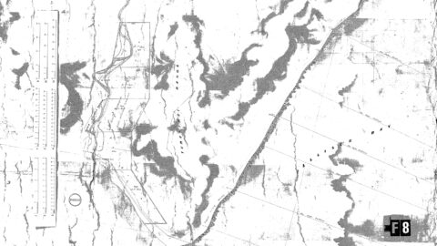
Partial plan of the Wai-nui-o-mata and O-Rongo-Rongo Districts – 31 Oct 1860. There are some interesting names and spellings...
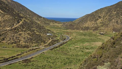
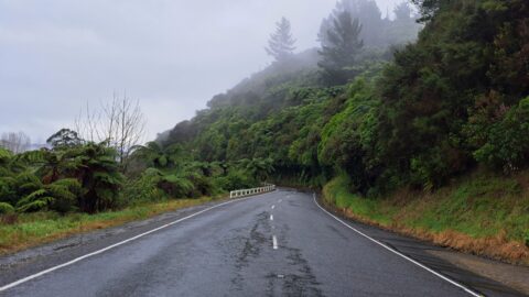
Coast Road in Wainuiomata, connects suburbia (Homedale) to the rugged southern coastline of the North Island.
Fitzherbert Road, originally known as Swamp Road before 1959, extended to the base of the hills leading to Naenae...
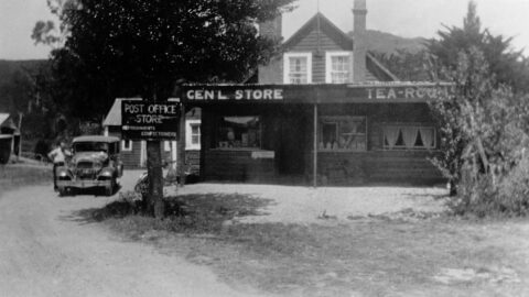
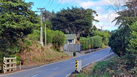
The McIlvride cottage on today’s Moores Valley Road was later expanded to include a store and post office.
Moores Valley Road connects the oldest shopping area to a valley that epitomises the rural charm of Wainuiomata.
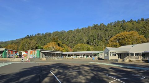
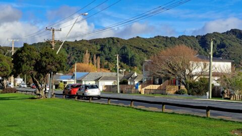
Established in 1857, Wainuiomata Primary School, a state school, resides in Homedale, the oldest suburb in Wainuiomata.
The McIlvride family holds a notable place in the early European settlement history of Wainuiomata. Their roots trace back...
The story of Moness begins with Hugh Sinclair's arrival in New Zealand in 1839. About nine years later,...
Glenhill was the family house of John Sinclair, located around 136 Hine Road today. Glenhill means a narrow...
Mutuihe Farm was the homestead of William Bertram White, one of the earliest European settlers in Wainuiomata.
WAINUIOMATA TOURS

Step into the wilderness of Wainuiomata and experience it for yourself. Learn more →.
WAINUIOMATA MUSEUM

Located in Wainuiomata Primary School, it is open 2pm-4pm every Sunday. Learn more →.
BUY ME A COFFEE
Support Wainuiomata.Net with a donation and help us continue to uncover local history, capture photos, drink coffee, and promote Wainuiomata.
Scan or click the code below:


DISCUSSION