
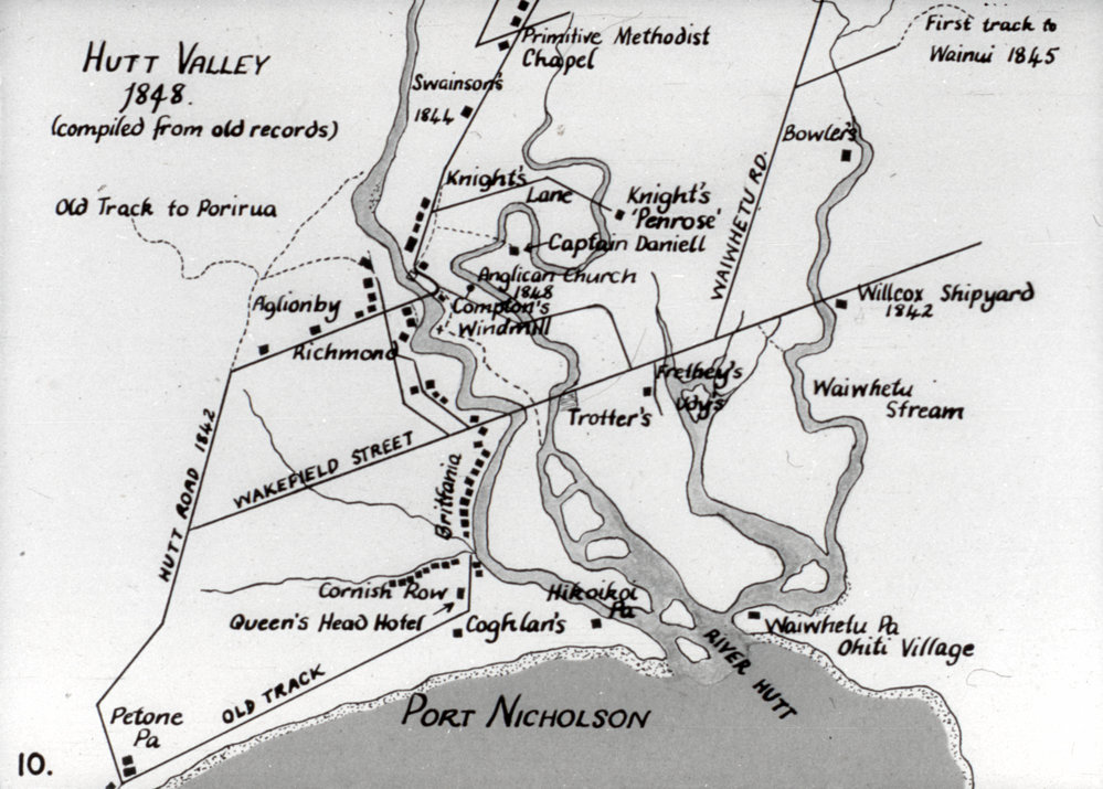
A map from 1848 of the Hutt Valley showing the first track to Wainuiomata in a location different from the present-day Wainuiomata Road.
Hutt Valley 1848
The following is the useful text shown on the map, organised by type. I have preserved the historic spellings used on the map. The National Library catalogue for the original also confirms a number of the less distinct names, including Frethey, Udy, Trotter, Coghlan and Willcox.
Roads and Tracks
- Hutt Road 1842
- Wakefield Street
- Wainuihetu Rd.
- Old Track
- Old Track to Porirua
- First track to Wainui 1845
- Knight’s Lane
Settlements and Localities
- Richmond
- Britannia
- Cornish Row
Māori Settlements and Pā
- Petone Pa
- Hikoikoi Pa
- Waiwhetu Pa
- Ohiti Village
Rivers, Streams and Harbour
- River Hutt
- Waiwhetu Stream
- Port Nicholson
Churches and Religious Buildings
- Primitive Methodist Chapel
- Anglican Church 1848
Hotels, Mills and Businesses
- Queen’s Head Hotel
- Compton’s Windmill
- Willcox Shipyard 1842
Properties, Settlers and Other Names
- Aglionby
- Swainson’s 1844
- Knight’s “Penrose”
- Captain Daniell
- Bowler’s
- Frethey’s
- Udy’s
- Trotter’s
- Coghlan’s




)