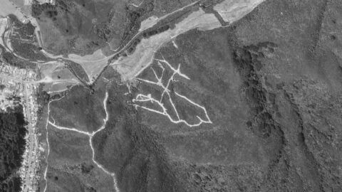
Old aerial photos of Reservoir Valley reveal a network of firebreaks created for geological surveys assessing the feasibility of...
Wainuiomata: History
Articles exploring the history of Wainuiomata, dating back to the 1860s
Documenting the fascinating history of Wainuiomata with an ever growing collection of articles. Includes posts about the origins and pioneering period of Wainuiomata to historical sites and artefacts. Each article is dated, but the date represents the subject and not the date when the article was written. For example, when an article primarily focuses on a photograph captured in 1840 or discusses topics related to that specific year, the article will be time stamped with that year.
This approach provides readers with an experience, allowing them to traverse through history in chronological order and gain a precise understanding of how historical events and elements are situated within the broader timeline of Wainuiomata’s history. Nonetheless, when an article covers a lengthy period concerning its main subject, it will be time stamped based on the featured image, most recent image, or the date of the main subject.
Read our comprehensive page on Wainuiomata history here →
Historical Articles
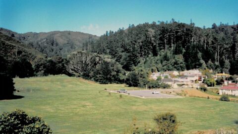
Pictured is Hine Road Recreation Area in 1989. You can clearly see the old maintenance road above Reservoir Road.
A view from the year 1989, looking at the tunnel entrance to the concrete well in Wainuiomata with Reservoir...
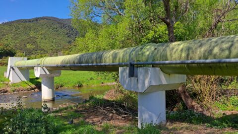
In 1988, a new water pipeline known as the green pipe was constructed, running alongside the existing pipelines.
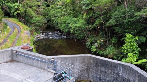
In the 1980s, the Morton Dam was decommissioned. The current system features two strategically positioned weirs along the river...
Gazing down on Sunny Grove from the Mount Crowther Track in 1988, the firebreak and track behind the odd-numbered...
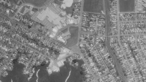
Aerial photos showing the first intersection upon entering Wainuiomata, where Main Road meets Fitzherbert Road.
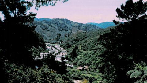
Looking down on the Hine Road Recreation Area in 1987, one can see the absence of the Wainuiomata Garden...
The Wainuiomata police yesterday made a breakthrough in their search for dental records to identify positively a pilot killed.
The body of a man killed in a light plane crash near Wellington last month has still not been formally identified.
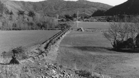
Looking at the two water pipes in Richard Prouse Park from Reservoir Road toward Wainuiomata River. Today, there is...
A light twin-engine aircraft carrying two or three persons crashed on Orongorongo Station, south of Wainuiomata last night.
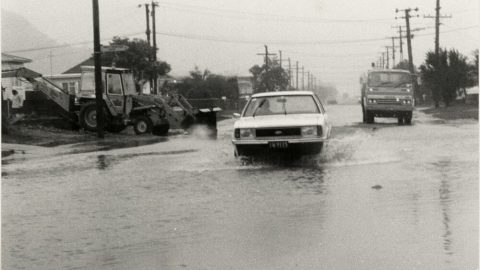
Photograph showing a car pushing through floodwaters along Wise Street in Wainuiomata, creating waves as it moves.
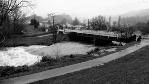
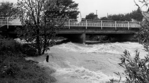
Looking at Wainuiomata River in flood with Main Road Bridge and the Rotary Park entrance in the background. Date:...
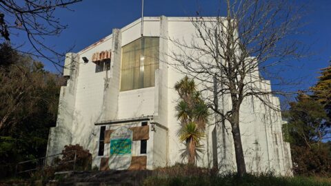
St John’s Anglican Church is situated on Dick’s Hill, just behind The Village in Wainuiomata. Its exact address is...
Mr Arnold Heine, says a school outing that ended with 10 children lost in Wellington's Wainuiomata bush was "completely...
A swollen Wainuiomata River flowing under Main Road Bridge with Wainuiomata Primary School just in view. Date: 21st May,1981.
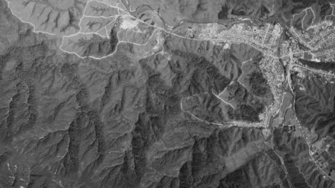
Aerial photograph from the 6th of October in 1980, showing Homedale and Reservoir Valley. Numerous firebreaks are visible.
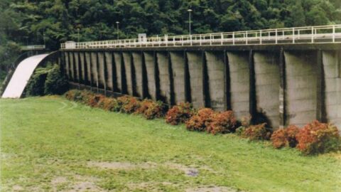
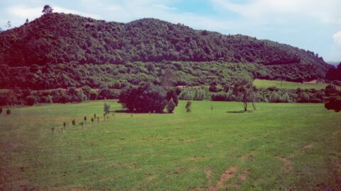
Photos of Morton Dam, circa 1980. In view is the dam, spillway, and a walkway that went through the...
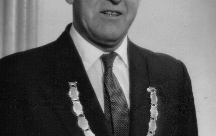
Norman Willis, a land developer and owner, established a subdivision in Homedale, Wainuiomata in the late 1950s – 1960s.
WAINUIOMATA TOURS

Step into the wilderness of Wainuiomata and experience it for yourself. Learn more →.
WAINUIOMATA MUSEUM

Located in Wainuiomata Primary School, it is open 2pm-4pm every Sunday. Learn more →.
BUY ME A COFFEE
Support Wainuiomata.Net with a donation and help us continue to uncover local history, capture photos, drink coffee, and promote Wainuiomata.
Scan or click the code below:


DISCUSSION