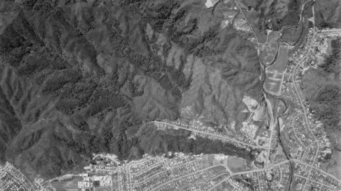
An aerial photograph taken on 30th December 1974 captures the upper Moores Valley of Wainuiomata with Naenae also in...
Wainuiomata: History
Articles exploring the history of Wainuiomata, dating back to the 1860s
Documenting the fascinating history of Wainuiomata with an ever growing collection of articles. Includes posts about the origins and pioneering period of Wainuiomata to historical sites and artefacts. Each article is dated, but the date represents the subject and not the date when the article was written. For example, when an article primarily focuses on a photograph captured in 1840 or discusses topics related to that specific year, the article will be time stamped with that year.
This approach provides readers with an experience, allowing them to traverse through history in chronological order and gain a precise understanding of how historical events and elements are situated within the broader timeline of Wainuiomata’s history. Nonetheless, when an article covers a lengthy period concerning its main subject, it will be time stamped based on the featured image, most recent image, or the date of the main subject.
Read our comprehensive page on Wainuiomata history here →
Historical Articles
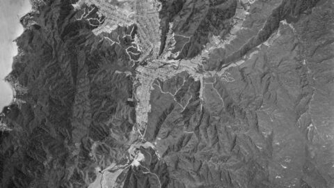
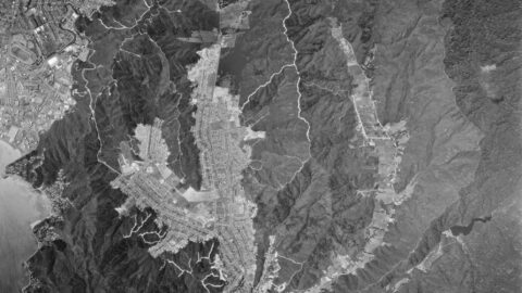
This aerial photo, taken on 30 December 1974, showcases Wainuiomata and the extensive firebreaks on its surrounding hills.
The aerial image of Wainuiomata in 1974 is similar to the layout today. But the hills are crisscrossed with...
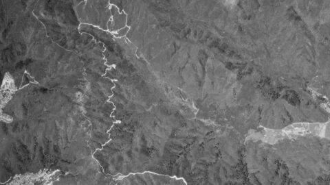
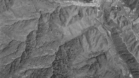
1974 aerial photograph depicting Homedale and Reservoir Valley, showcasing numerous firebreaks present during that era.
Aerial image of Wainuiomata in the year 1974. The image contains numerous freshly cut firebreaks on the surrounding hills.
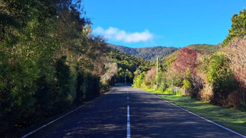
From the main road around the western side of Wellington Harbour can still be seen the capital city’s best-known...
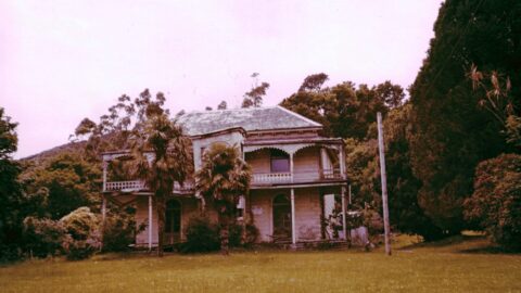
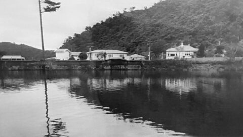
A memory around 1972 of 'Northbrook' house in Wainuiomata which was originally inhabited by the Wood family.
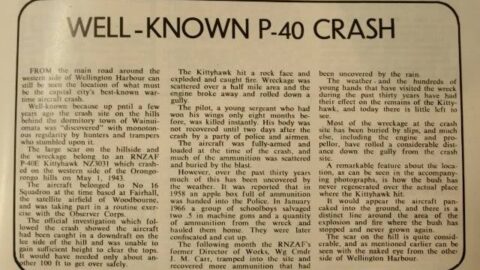
Parts of a wartime Kittyhawk fighter which crashed in the Orongorongo Ranges near Wainuiomata 27 years ago were salvaged...
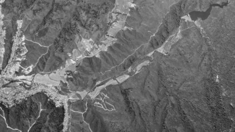
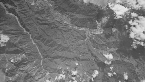
In this 1969 aerial image, you can see Hine Road, Sunny Grove, Moores Valley, & Reservoir Valley. See the...
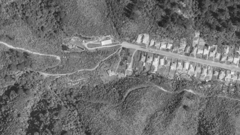
Aerial photo taken in 1969 of Homedale and Moohan Street area in Wainuiomata. A number of interesting features...
The O-K Kinney Strainer Chamber formed part of the O-K pipeline system, which carried raw water from the Orongorongo...
An interesting view of the top of Sunny Grove in 1969, showing the Black House, water tanks, and surrounding...
Explore the history of Whitcher Grove, once home to the Sinclair family, known for their mill operation and stately...
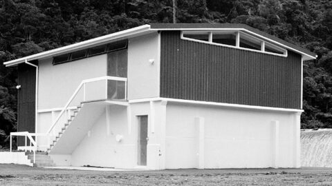
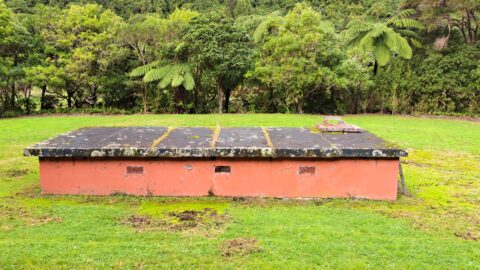
The Morton Dam Strainer Building in Wainuiomata filtered water from the dam before it was piped to Wellington.
Images and memories capturing the essence of the Wainuiomata Waterworks as shared by the Reidy Family, and conveyed by...
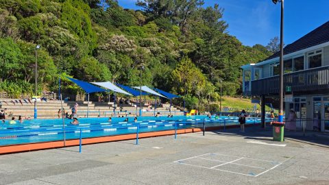
The Wainuiomata Baths is are one of the valley’s most enduring community facilities and have played a central role...
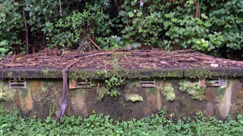
A structure containing 4 venturi meters to measure water flow on the O-K pipeline was constructed in the 1960s.
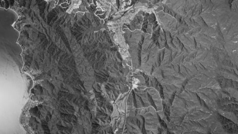
This aerial photo, taken on 7 December 1966, captures Wainuiomata during a period of development. Arakura is shown under...
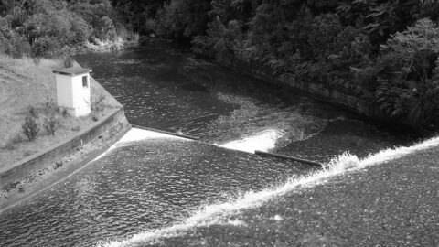
Looking over the spillway of Morton Dam circa 1965. In view is the Morton Dam Strainer Building which was...
Willis Grove traces its origins to the time when the valley was transitioning from farmland and bush into a...
WAINUIOMATA TOURS

Step into the wilderness of Wainuiomata and experience it for yourself. Learn more →.
WAINUIOMATA MUSEUM

Located in Wainuiomata Primary School, it is open 2pm-4pm every Sunday. Learn more →.
BUY ME A COFFEE
Support Wainuiomata.Net with a donation and help us continue to uncover local history, capture photos, drink coffee, and promote Wainuiomata.
Scan or click the code below:


DISCUSSION