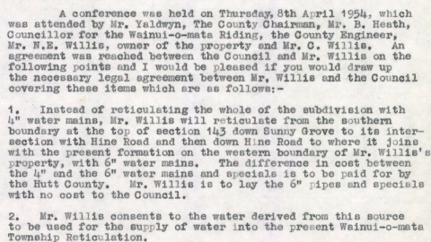
Reticulate the subdivision for water supply and he intended to do this from a creek which originates in a...
Wainuiomata: History
Articles exploring the history of Wainuiomata, dating back to the 1860s
Documenting the fascinating history of Wainuiomata with an ever growing collection of articles. Includes posts about the origins and pioneering period of Wainuiomata to historical sites and artefacts. Each article is dated, but the date represents the subject and not the date when the article was written. For example, when an article primarily focuses on a photograph captured in 1840 or discusses topics related to that specific year, the article will be time stamped with that year.
This approach provides readers with an experience, allowing them to traverse through history in chronological order and gain a precise understanding of how historical events and elements are situated within the broader timeline of Wainuiomata’s history. Nonetheless, when an article covers a lengthy period concerning its main subject, it will be time stamped based on the featured image, most recent image, or the date of the main subject.
Read our comprehensive page on Wainuiomata history here →
Historical Articles
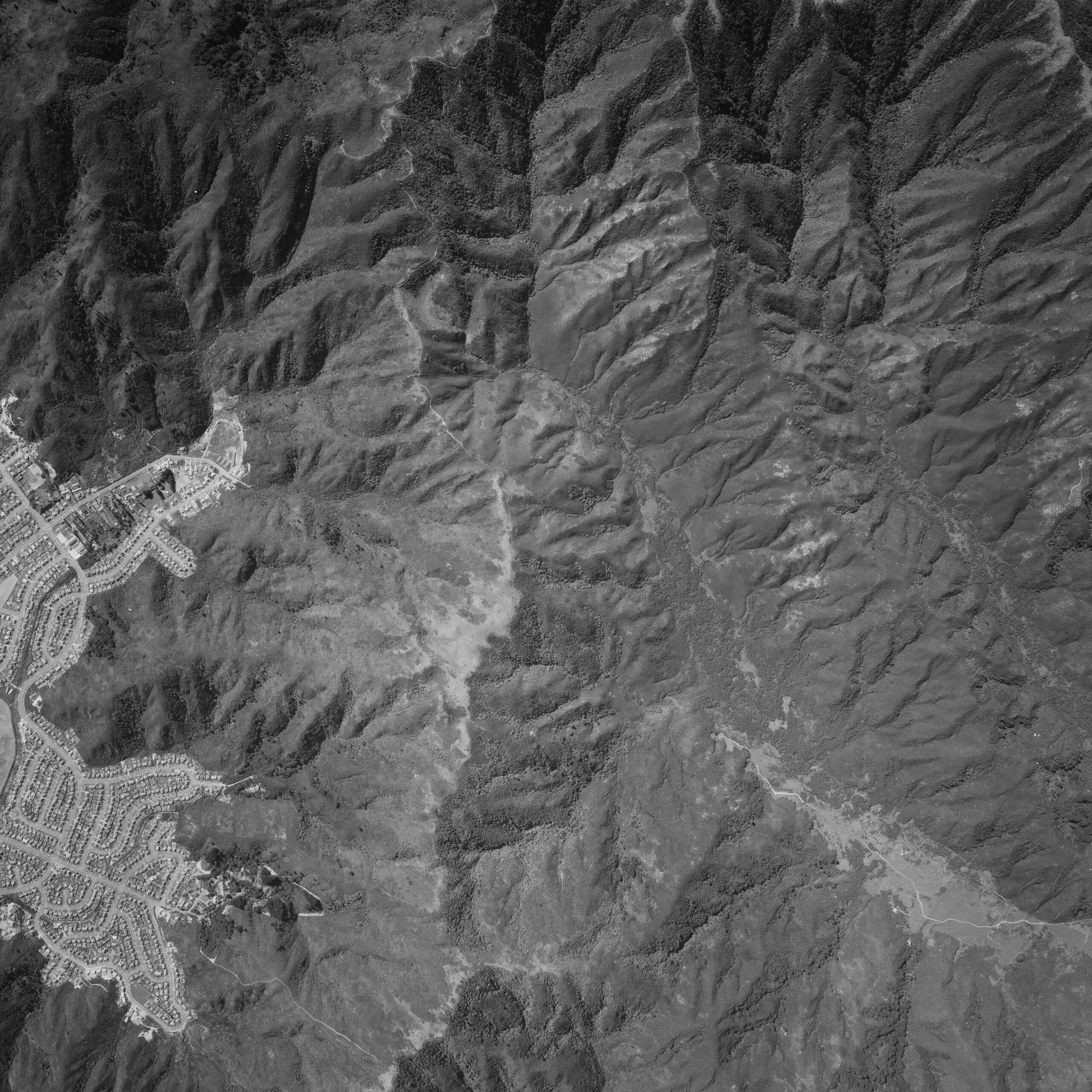
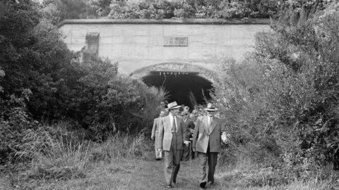
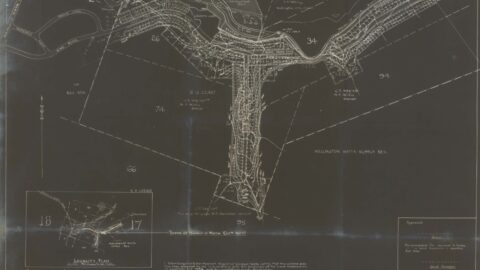
An aerial photograph taken on 30th December 1974 captures the upper Moores Valley and you can see the Strand...

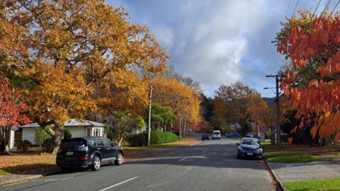
The Strand in Wainuiomata is one of the main commercial streets, complementing Queen Street as part of the central...
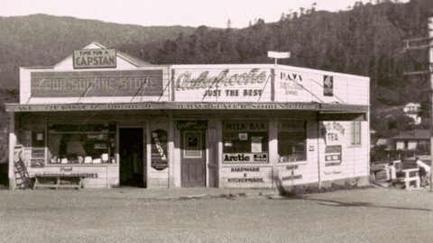
Lovegrove's Store, situated at the intersection of Moore's Valley and Main Road, underwent significant alterations and extensions in 1954.
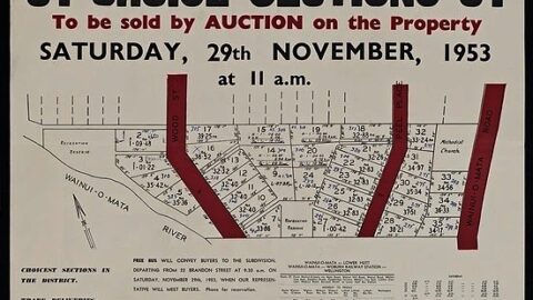
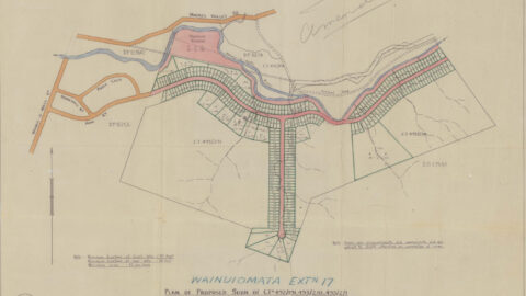
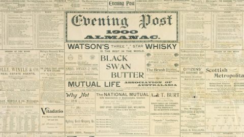
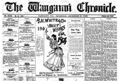
The Faulkes subdivision, Wainui-o-mata Road, Peel Place and Wood Street, Wainui-o-mata : 31 choice sections. H. Ernest Leighton &...
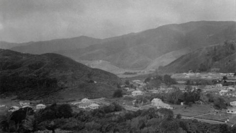
In the late 1920s, the Wainuiomata Development Company aimed to improve access to the Hutt Valley by building a...
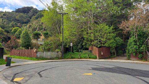
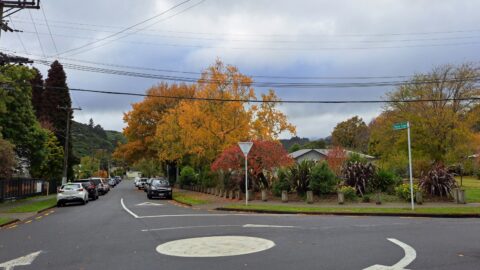
Hair Street branches off Moores Valley Road near The Village. Despite its proximity to shops, the street feels secluded.
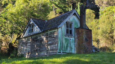
Discover the history of a hut on Hine Road in Wainuiomata, including its early residents and its mysterious origin.
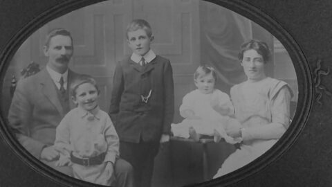
Edgar Hine emigrated to New Zealand in 1879. He was a bond holder in the Wainuiomata Development Company as...
Did you know in 1948, plans for the Hine Road and Sunny Grove area had Hine Road extend all...
A Norman Willis subdivision plan for the Hine Road and Sunny Grove area. This map shows Hine Road extending...
Poole Crescent connects to both Homedale Road and Hine Road, with a reserve situated behind. The street was named...
The photo shows a view along Rowe Parade, taken from the area where Stanley Street and Sharp Crescent would...
Hine Road, nestled in the heart of Homedale in Wainuiomata, extends from Main Road and culminates at Hine Road...
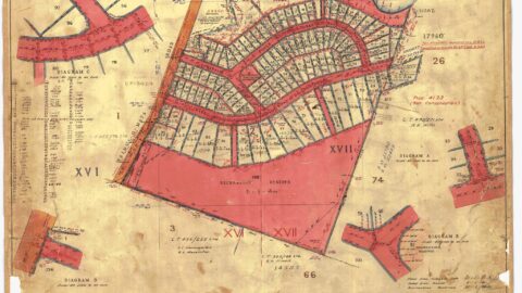
The surveyed subdivision plan from 1945 outlines the development of Hine & Homedale Road, as well as Poole Crescent.
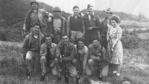
A group of American GIs from Hutt Park Camp, together with local lads and Maisie Burt, pictured at Wainuiomata...
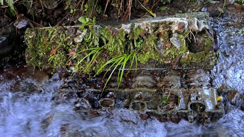
A party of United States marines took a heavy six-wheeled truck five miles up the bed of a creek...
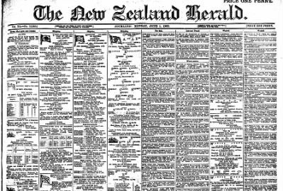
That Sergeant Pilot Thomas Victor Marchant died from injuries suffered in a crash at Wainui-o-mata on May 1.
Sergeant Thomas Victor Marchant, P-.N.Z.A.F. lost his life on Saturday afternoon. when the aircraft in which he was the sole occupant...
History of Kittyhawk 3031, a plane that crashed in the hills in Wainuiomata in 1943. Includes photos of the...
WAINUIOMATA TOURS

Step into the wilderness of Wainuiomata and experience it for yourself. Learn more →.
WAINUIOMATA MUSEUM

Located in Wainuiomata Primary School, it is open 2pm-4pm every Sunday. Learn more →.
BUY ME A COFFEE
Support Wainuiomata.Net with a donation and help us continue to uncover local history, capture photos, drink coffee, and promote Wainuiomata.
Scan or click the code below:


DISCUSSION