
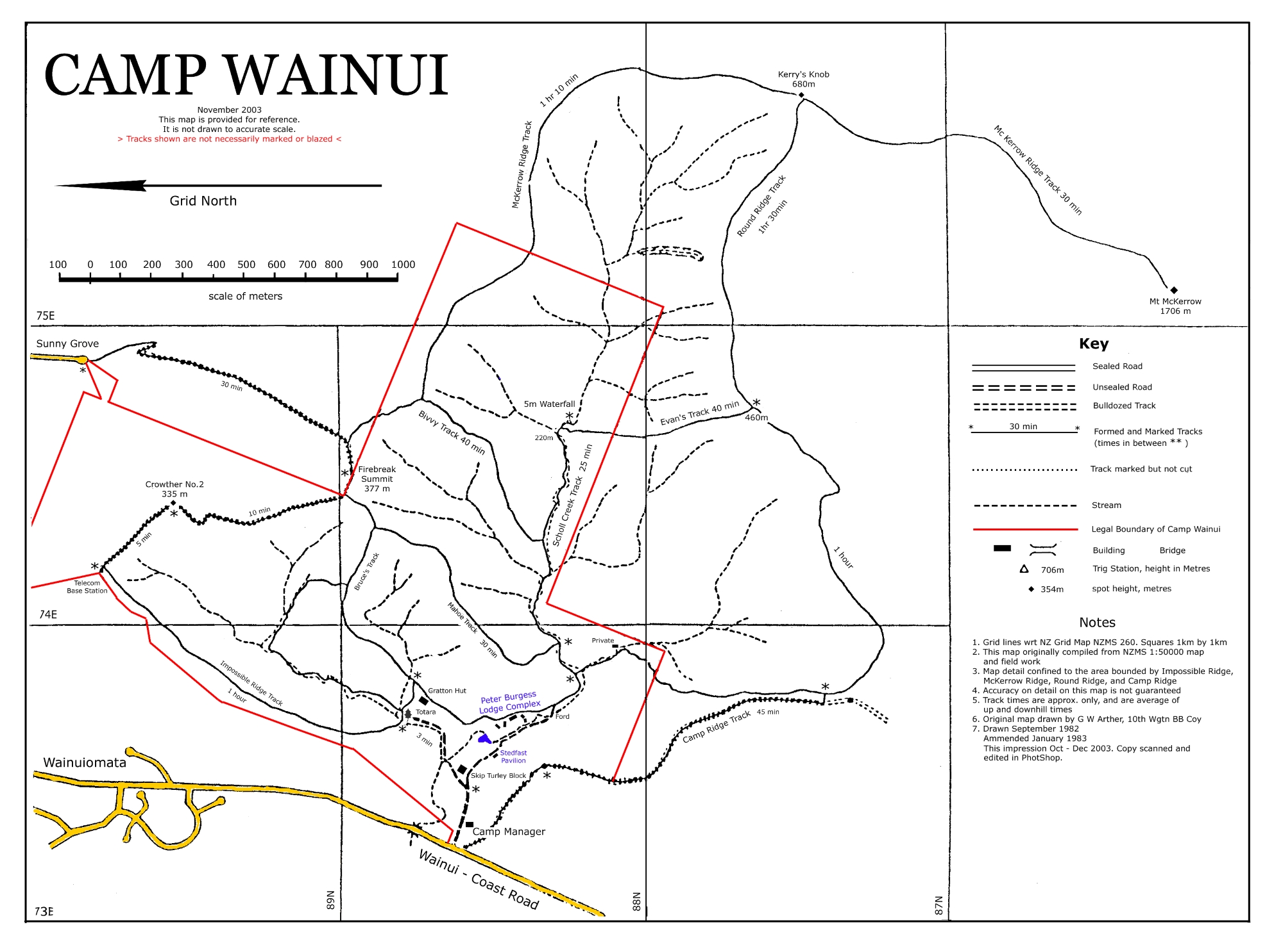
This Camp Wainui map shows numerous tracks throughout the area, along with creeks and natural features such as waterfalls. As the map dates from 2003, some of these tracks may now be overgrown, altered or no longer clearly defined.
CAMP WAINUI
November 2003
This map is provided for reference.
It is not drawn to accurate scale.
> Tracks shown are not necessarily marked or blazed <
Grid North
scale of meters
Main place and track names
Sunny Grove
Wainuiomata
Wainui – Coast Road
Crowther No. 2 – 335m
Telecom Base Station
Firebreak Summit – 377m
Kerry’s Knob – 680m
Mt McKerrow – 1706m
Mt McKerrow Ridge Track
Prouse Ridge Track
Evans Track
5m Waterfall – 220m
Scholes Creek Track
Bivy Track
Rifle Range
Gratton Hut
Totara
Peter Burgess Lodge Complex
Ford
Skip Taylor Block
Camp Manager
Camp Ridge Track
The map also marks a number of unnamed streams and connecting tracks.
Key
Sealed Road
Unsealed Road
Bulldozed Track
Formed and Marked Tracks
(times in between * *)
Track marked but not cut
Stream
Legal Boundary of Camp Wainui
Building
Bridge
Trig Station, height in Metres
spot height, metres
Notes
- Grid lines wrt NZ Grid Map NZMS 260. Squares 1km by 1km
- This map originally compiled from NZMS 1:50000 map and field work
- Map detail confined to the area bounded by Impossible Ridge, McKerrow Ridge, Round Ridge, and Camp Ridge
- Accuracy on detail on this map is not guaranteed
- Track times are approx. only, and an average of up and downhill times
- Original map drawn by G W Archer, 10th Wgtn BB Coy
- Drawn September 1982
Amended January 1983
This Impression Oct – Dec 2003. Copy scanned and edited in PhotoShop.




