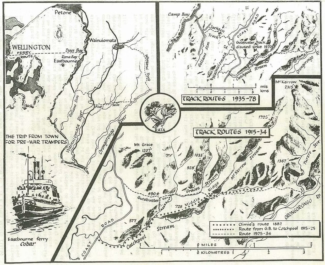
This historic map illustrates the development of tramping routes through the hills between Eastbourne, Wainuiomata and the Orongorongo Valley from the late nineteenth century through to 1978. It shows early routes used by trampers travelling from Wellington by ferry to Eastbourne and Days Bay, before heading inland through Gollans Valley and the surrounding ranges.
Of particular interest are Climie’s 1882 route, the Gutsbuster Track, McKerrow Ridge and the changing routes into the Catchpool and Orongorongo valleys. The map distinguishes tracks used between 1915 and 1934 from those used between 1935 and 1978, providing a fascinating record of how access to the region evolved over nearly a century.