
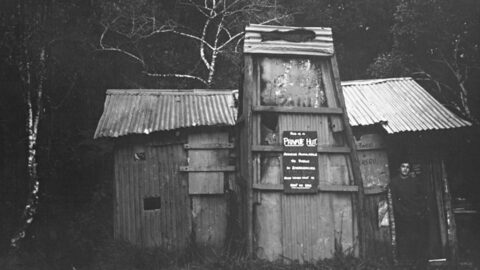
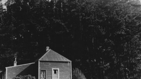
This is a photo of a private hut in Catchpool Valley, Wainuiomata. The valley used to have numerous private...
Wainuiomata: Photos (Page 16)
Photographic timeline of Wainuiomata
Documenting Wainuiomata with an ever growing collection of photos. This includes locations such as the town centre, suburbs, landscapes, coastline, rivers, and reserves.
Photo articles are dated by the age of the main photo or the main subject rather than when the article was written. This places the photos in a timeline. Some photos date back to the 1800s. We either have permission to show these old photos or they have no copyright. Modern photos on the site were taken by David Johnson of Wainuiomata.Net unless otherwise specified.
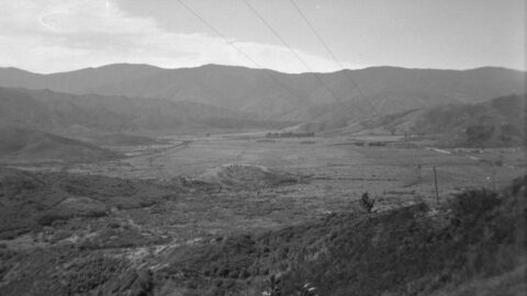
Looking at Wainuiomata Valley from atop Wainuiomata Hill circa 1949 reveals the absence of suburbs. The valley contains mostly...
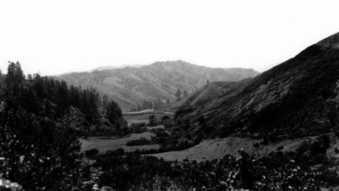
Looking at Sunny Grove when it was farmland in the 1940s. In view is farmland surrounded by hills and...
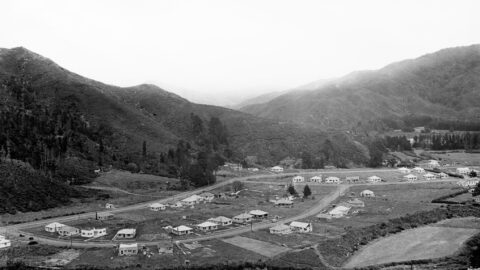
Aerial view of Homedale (circa 1946) showing some interesting features. They are as follows: 23 houses in Poole Crescent;
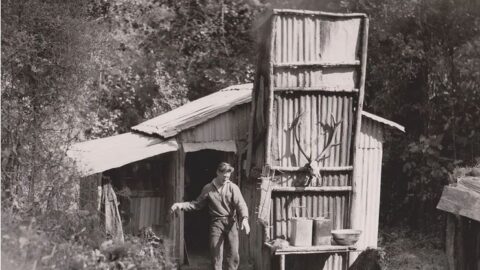
This is the original research station established by Internal Affairs to seek ways to control the possum problem. Photo...
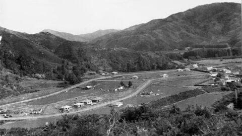
Aerial view of Homedale (mid 1946) showing some interesting features. They are as follows: 9 houses in Poole Crescent;
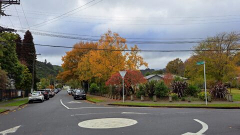
Poole Crescent connects to both Homedale Road and Hine Road, with a reserve situated behind. The street was named...
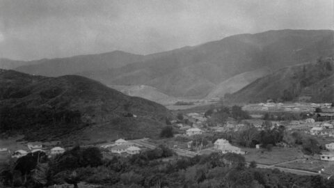
The photo shows a view along Rowe Parade, taken from the area where Stanley Street and Sharp Crescent would...
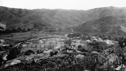
Looking down upon The Village in the year 1946. The outlook encompasses Moores Valley Road, Main Road, and various...
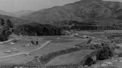
View of Homedale in 1945. Housing development had just begun, with several older farmhouses still visible.
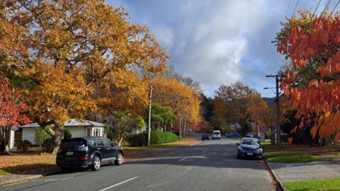
Hine Road, nestled in the heart of Homedale in Wainuiomata, extends from Main Road and culminates at Hine Road...
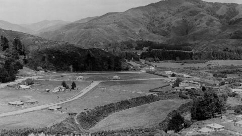
Aerial view of Homedale (circa 1945) showing some interesting features. Inc: old school buildings and Main Road Bridge.
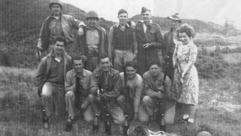
A group of American GIs from Hutt Park Camp, together with local lads and Maisie Burt, pictured at Wainuiomata...
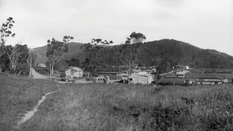
This photo shows the Williams General Store on Main Road, around 1939. The building was originally part of McIlvride...
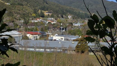
Explore the history of Burden Avenue in Wainuiomata, from its 1940s development and local industry to its homes and...
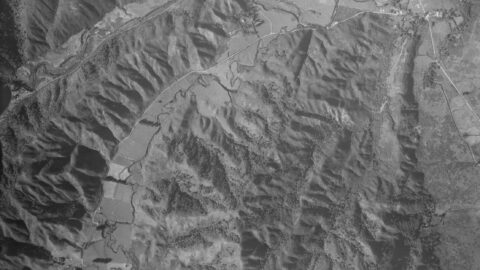
An aerial photograph taken in 1942 Moores Valley and Reservoir Valley, extending up to the old dam. Both valleys...
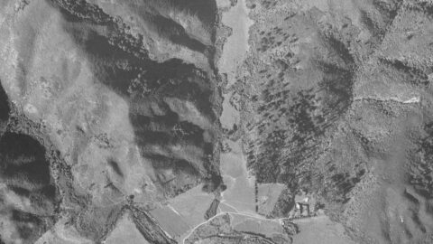
In the past, Skerretts Creek used to wind through both sides of the Sunny Grove valley. However, the creek...
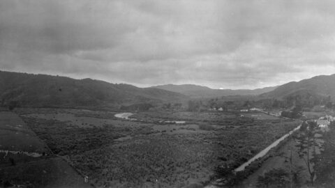
Farmland in Homedale, looking north towards the village from Coast Road. In view are the school, the school house,...
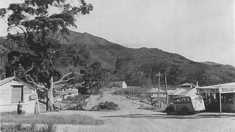
View of The Village, circa 1941. The Wainuiomata Transport building to the right, was known as Claude's shop.
WAINUIOMATA TOURS

Step into the wilderness of Wainuiomata and experience it for yourself. Learn more →.
WAINUIOMATA MUSEUM

Located in Wainuiomata Primary School, it is open 2pm-4pm every Sunday. Learn more →.
BUY ME A COFFEE
Support Wainuiomata.Net with a donation and help us continue to uncover local history, capture photos, drink coffee, and promote Wainuiomata.
Scan or click the code below:


Support
Make a donation and help us continue to uncover local history, capture photos, drink coffee, and promote Wainuiomata.
Scan or click the code below:
DISCUSSION